The following is the list of interns who have been officially onboarded to the National Geospatial Internship.
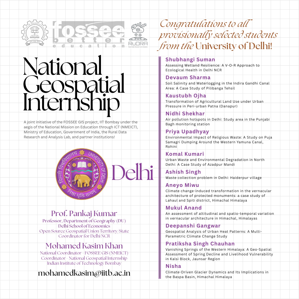
Institute Name: Delhi School of Economics, Delhi University
Theme: GeoAI, Urban, Mountain Ecosystem, Hydrology
Faculty Mentor: Prof. Pankaj Kumar, Department of Geography, Delhi School of Economics, Delhi University
Department/Batch: Master's in Geography (M.Sc./M.A.)
IIT Bombay Mentors: Prof. Pennan Chinnasamy, Mohamed Kasim Khan M
First evaluation: 30 April 2026
Final Evaluation: 15 June 2026
Theme: Rural Development
Institute Name: Gandhigram Rural Institute (Deemed to be University - under the Ministry of Education, Government of India), Dindigul, Tamil Nadu, India
Faculty Mentor: Dr. Muthukumar, Director (i/c), Centre for Geoinformatics, GRI (Primary Mentor)
Department/Batch: Master's in Geoinformatics
IIT Bombay Mentors: Prof. Pennan Chinnasamy, Mohamed Kasim Khan M
First evaluation: 27 April 2026
Final Evaluation: 15 June 2026
Name | Problem Statement/ Title |
Yogesh K.S | Integrated Geospatial-Based Smart Urban Planning Model for Sustainable Development of Kumbakonam |
Nithya Latshmi.S | Streetlight Availability & Dark-Spot Mapping in Nachiyarpuram- Theni district |
Vignesh.M | GIS-Based Agricultural Suitability Analysis for Paddy Cultivation in Kudavasal Taluka -Thiruvarur District, Tamil Nadu, India |
Mohana Sankare.S | Hydrological Analysis of Rainfall–Runoff and Water Conservation Using GIS in Kolathur Taluk in the Cauvery River Basin |
Guljana.M | Terrain-Based Solar Suitability Analysis for Off-Grid Energy Infrastructure: A Case Study of Andipatti Block, Theni District. |
Mainak Dhanantari | Forensic Geospatial Assessment of Riverbank Stability and Structural Vulnerability along the Varanasi Riverfront. |
Bhuvana.G | Meteorological Drought Assessment in Ramanathapuram Taluk, Tamil Nadu Using SPI (2020–2025) |
Sarika Jenifer.A | Shoreline Change Detection of Colachel Village using Remote Sensing and GIS |
Srikayathri.N | GIS-Based Agriculture Drought Risk and Crop Suitability Analysis for Vilathikulam – Thoothukudi District |
Vijay.P | Multi-Criteria Decision Making (MCDM) for Solar Power Plant Site Selection |
Pavankumar.C | Mapping and Analysis of Fallow Lands Using Remote Sensing and GIS in Dindigul District |
Dineshmathi.K | Assessment of Heat Stress Zones in Rural Areas Using GIS and Remote Sensing in Dindigul District |
Reni Maria Sheeba.B | Drought Vulnerability Assessment using Remote Sensing and GIS in Vedasundur, Dindigul District, Tamil Nadu |
Tamilselvi.M | Geospatial Analysis for Estimating Changes in Land Surface Temperature using Remote Sensing Data in Vadamadurai |
Kishore Kumar.J | Assessing groundwater quality for the suitability of irrigation in Dindigul district |
Karthika.R | Assessing water resources vulnerability to climate change using Geoinformatics |
Brindha.R | Uncertain Land Use Dynamics in Aathoor: Challenges in Understanding Land Utilization |
Pon Subiksha.R | Finding the Fastest Route to Healthcare for Rural Communities in Kanavaipatti and Thummalapatti using AI |
Durga.P | Estimation of Soil Erosion for Sirumalai Hills, Tamil Nadu, using Revised Universal Soil Loss Equation and Geoinformatics Techniques |
Naveena.P | Flood Risk Assessment and Mapping Around Vaigai Dam Using Remote Sensing & GIS Techniques |
Afrin Banu.M | Forest Fire Risk Zonation Mapping Using Geoinformatics techniques in Sirumalai hills, Dindigul district, Tamil nadu |
Palanimuthu.M | Coastal Vulnerability Index for Coastal Villages of Thoothukudi district Using Geoinformatics approach |
Anas Mohamed.M | Urban Expansion Analysis of Dindigul District Using Geoinformatics |
Sagaya Sangamithra J.P | Remote Sensing-based Assessment of Groundwater, Study of Vegetation Change and Land Surface Temperature Variation in Dindigul district, Tamil Nadu |
Karthiga.K | Spatial Analysis of Drinking Water Quality Using GIS in Rural Areas |
Vanmathi C.S | Site Suitability Analysis for Solid Waste Disposal in Dindigul District Using Remote Sensing & GIS |
Dhanyasri.S | Groundwater Potential Zone Mapping Using Remote Sensing and GIS |
Thangamalar.R | Spatial assessment of rural flood risk and water resource vulnerability in Cuddalore district using QGIS |
Mubashira. V.M | shoreline change analysis in the Nagapattinam coast |
Ranjithkumar.R | Groundwater Quality Mapping using Remote Sensing and GIS |
Vishnu Priya.M | Analysis of Land Degradation using LST and Vegetation Index in Dindigul District in Tamil Nadu |
Abishek.R | Groundwater potential identification using geoinfomatics techniques for Athoor Block, Dindigul district,District Tamil Nadu |
Alagumani.A | Site Suitability Analysis for Agroforestry Development Using GIS in Dindigul District |
Sivachandran K | Spatial-Temporal Assessment of Air Quality Dynamics in Dindigul District, Tamil Nadu. |
Harikrishnan S | Geoinformatics-Based Crop Health Monitoring Using NDVI in Dindigul District |
Institute Name: Aligarh Muslim University
Theme: Digital Twin, Hydrology, Urban
Faculty Mentor: Prof. Haris Hasan Khan, Department of Remote Sensing and GIS, Aligarh Muslim University
Department/Batch: Master's in Geography (M.Sc.)
IIT Bombay Mentors: Prof. Pennan Chinnasamy, Mohamed Kasim Khan M
First evaluation: 30 April 2026
Final Evaluation: 15 June 2026
IIT Bombay FOSSEE GIS (NMEICT) - National Geospatial Internship (Batches 01, 02 & 03)
NATIONAL GEOSPATIAL INTERNSHIP
(A joint initiative of the FOSSEE GIS project, Indian Institute of Technology Bombay, through the National Mission on Education through ICT, Ministry of Education, Government of India, the Rural Data Research and Analysis (RuDRA) Lab, and partner institutions)
About the National Geospatial Internship:
The National Geospatial Internship (NGI) 2025 is an initiative of the GIS/Geospatial vertical of the FOSSEE project developed at IIT Bombay under the aegis of the National Mission on Education through ICT (NMEICT), Ministry of Education, Government of India. The main objective of the NGI 2025 is to promote the usage of Free/Libre Open Source Geospatial Software, Indian satellite/ Earth Observation data (from ISRO’s Bhuvan, MOSDAC, VEDAS, Bhoonidhi, etc portals), shape files from the Survey of India (SOI) portal, Indigenous Indian technologies like NavIC (ISRO-SATNAV), all in adherence to the National Geospatial Policy 2022 (NGP2022-DST), the Indian Space Policy 2023 (ISRO-NRSC), for India specific real-life problem statements which shall either result in (i) the creation of thematic maps for the societal benefit that can be used by policymakers, administrators; (ii) creation of Open Source based Geospatial Dashboard; (iii) Open Source Geospatial Product Development.
The FOSSEE project developed at IIT Bombay promotes the usage of Free/Libre Open Source Software in Academia and Industry. All the activities of IIT Bombay FOSSEE GIS, including the National Geospatial Internship 2025, IIT Bombay FOSSEE Geospatial Mapathon, National GIS-IoT Hackathon, National Geospatial Awards 2025, etc, are organized under the aegis of the National Mission on Education through ICT (NMEICT, Ministry of Education, Government of India.
Important Dates:
Application window opens on 07 March 2025
Application window closes on 30 March 2026
Declaration of provisionally selected candidate list 02 April 2026*
Submission on reports (Phase 01): 25 April to 15 May 2026*
Submission on reports (final): 10 to 15 June 2026*
Certificate distribution to qualified interns: latest by 30 June 2026* (subject to satisfactory completion of the task required for the completion of the internship)
National Geospatial Internship 2025 Registration URL: https://forms.gle/ZJfvkB52vmaAwVkn9
Opportunity for Everyone!
The IIT Bombay FOSSEE GIS team has determined to allow as many eligible candidates as possible, covering all the districts in every state and union territory of India. This step is aimed towards enabling the coveted internship tag to be bagged even by the student from remotest corner of the country with special purpose vehicle created to tap (i) the unreached regions of Jammu & Kashmir, Ladakh, all seven North-Eastern States, Andaman and Nicobar Islands, and Lakshadweep; (ii) Rural areas and marginalized scheduled communities, etc. The IIT Bombay FOSSEE GIS team endeavors to spread awareness of Free/Libre Open Source Geospatial Software through such avenues. The Institutions identified as ‘Open Source Geospatial Knowledge Centers’ shall serve as local mentor institutes for students with limited resources. For any queries, please write to mohamedkasim@iitb.ac.in.
Joint Mentorship (IIT Bombay FOSSEE GIS + The RuDRA Lab + partner organizations/Industry + Host Institution):
By default, every selected intern shall have mentors assigned from the IIT Bombay FOSSEE GIS team (Prof. Pennan Chinnasamy, Co. PI. FOSSEE, and Mohamed Kasim Khan, National Coordinator FOSSEE GIS (NMEICT)). It is highly recommended for the applicants to have a local faculty as mentor from the host institution and/or from Industry/Government Organization. Faculty who were awarded the National Geospatial Faculty Fellow (NGFF) and the National Geospatial Emerging Faculty Fellow (NGEFF) during the National Geospatial Awards 2024 (Edition 01) at IIT Bombay can directly nominate students from their institution for NGI2025 (following the regular registration process).
Important Instructions for Prospective Interns:
The applicant must be a citizen of India and a bonafide student of any Institute of National importance (IIT/NIT/IISER/NITTTR/etc) or any UGC/AICTE/State/Union Government approved University/College/Institute/Research Organization in India, enrolled in any relevant UG/PG degree in Engineering/Science/Medicine/Arts/Management/Maritime Studies, etc
NGI 2025 is a remote internship (online/hybrid mode) offered on a ‘pro bono’ basis. There is NO registration fee.
Institutions that have adopted the National Education Policy 2020 (NEP2020) shall be given preference during the scrutiny of applications. Adhering to FOSSEE GIS mandates is mandatory.
Students who are already doing their final year internship in the geospatial domain or any interdisciplinary field, having an inclination towards GIS/Remote Sensing or developing geospatial applications, all using Open Source tools, can also apply. In this case, the applicant must clearly specify the study area in India, methodology, source of data sets, the timeline of completion, etc.
All the applicants irrespective of their application criteria must keep the following documents ready while filling out the NGI2025 Registration form... (i) NOC (from the head of the Institute); (ii) Updated Curriculum Vitae (CV); (iii) Statement of Purpose (S.o.P.) 01 page max.; (iv) Research Proposal (02 pages max.); (v) Copy of ID card; (vi) Latest Passport size photo (formal).
Incomplete or invalid applications shall be directly discarded. Candidates who provide wrong information during the registration process, if selected, shall be automatically disqualified from the internship.
College passouts/ freshers can also apply. Candidates who have already taken an internship with FOSSEE GIS or who were shortlisted but didn’t continue shall not be considered for “NGI 2025”.
Mere application doesn’t make anyone directly eligible for the Internship. The final decision of the “NGI 2025” organizing committee (IIT Bombay FOSSEE GIS) shall be final and non-appealable in all circumstances.
For institutional queries related to the NGI2025, please write to Mr. Mohamed Kasim Khan, National Coordinator, FOSSEE GIS (NMEICT), IIT Bombay at <mohamedkasim@iitb.ac.in>.
Note :
- Here's a breakdown of the selection criteria for each batch:
- Batch 01: Students from partner institutions who have either submitted their internship report or are in the process of doing so under the guidance of the National Geospatial Faculty Fellow Award Winner or a distinguished university.
- Batch 02: Unemployed youth, College Freshers, and Recent Pass-out students applying through their alma mater, state Skill development body, or endorsed by a Geospatial Startup/MNC.
- Batch 03: Current students who have registered through various channels, with preference given to the problem statements proposed by the District Collector(s), Municipal Corporation Commissioners, Government Department(s), and Industry (adhering to FOSSEE GIS mandates).
- The decision of the IIT Bombay FOSSEE GIS (NMEICT) team shall be final and non-appealable.
- Incomplete applications shall be automatically discarded.
- Only the provisionally shortlisted candidates shall receive the communication.
- Mere shortlisting doesn't make one qualify to get the certificate. The final certificate will only be awarded on satisfactory performance of the candidate at all stages, and the final report is subject to scrutiny by the organizing committee.
- The following is the tentative/provisional list of candidates shortlisted for the National Geospatial Internship, which comes under Batch 03 (Students of National Geospatial Awards Winners, and Champions and Winners of IIT Bombay FOSSEE Geospatial Mapathon (Edition 03 (2023); 04 (2024) and 05 (2025))).
- The shortlisted candidates for all three batches will be announced in phases starting from 11 November 2025, coinciding with India's National Education Day.
Note : The final list of interns receiving the certificates will be based on the completion of tasks and submission of a report (scrutinized and approved by the IIT Bombay FOSSEE GIS project and the RuDRA Lab team).