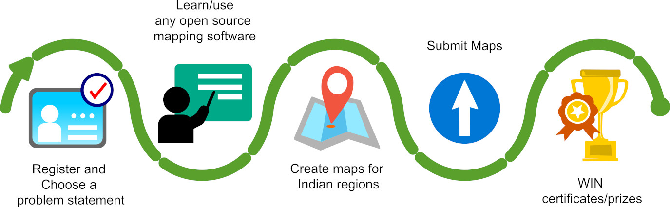
A national-level open-source-based collaborative geospatial challenge
https://iitb-mapathon-2024.fossee.in
Partners and Organisers
![]()
![]()
Important Dates
| Registration start date | Feb 15, 2025 |
| Registration end date | June 25, 2025 |
| Orientation | June 10, 2025 |
| Doubt clearing session 01 | June 25, 2025 |
| Doubt clearing session 02 | June 30, 2025 |
| Submission start date | June 01, 2025 |
| Submission end date | June 30, 2024 |
| Mapathon Evaluation | July 01 to July 03, 2025 |
| 01 minute (recording) presentation submission by winners | July 05, 2025 (by Champions/ Winners) |
| Declaration of Results* | TBD |
FOSSEE GIS Mandates
The following are the mandates of the IIT Bombay FOSSEE GIS team. It is requested that the applicant(s) before or during the time of registration go through all the mandates laid out by the IIT Bombay FOSSEE GIS team, and adhere to it. It any violation/ breach of any mandate is found at any phase of the Mapathon, the concerned team(s) shall be disqualified without any further notice. It is also to be noted that at all times, the decision of the IIT Bombay FOSSEE GIS team shall be final and non-appealable.
- Indian Citizen Only
- Must be a bonafide student/alumni of UGC/AICTE/AIU recognized University/ College/ Research Organization in India
- Use only Free/Libre Open Source Software
- Use only Open Source Hardware
- Align with any SDG. Work on real-life data sets.
- Adhere to the Indian National Geospatial Policy
- Use Indian Satellite data, and shape file only from the Survey of India portal
- Inclined towards Gati Shakti (recommended).
The decision of the IIT Bombay FOSSEE GIS team will be final in all circumstances and non-appealable. By registering and participating in the Mapathon, the participant(s)/ team(s) will be bound to the mandates and shall be expected to abide by them.
ImpactsInternet-based
Mapathon Themes
| Agriculture | Hydrology |
| Drones | Civil Engineering |
| Case Study with Policy impacts | Oceanography |
| Forestry | Gaming |
| Remote Sensing | Landscaping |
| Geology | Geostatistics |
| Groundwater | GIS in Medical Sciences |
| Transport | City Planning |
| Transport | Glacier |
| Internet based Case Study | Land Use Land Cover of Districts in India |
| Media GIS Case Study | Medicine |
| Environmental | Municipal GIS Case Study |
| Urban GIS Case Study | Mining GIS Case Study |
| Refineries in India | Automobile GIS Case Study |
| Nautical GIS Case Study | Ocean GIS Case Study |
| Oil & Gas GIS Case Study | Park GIS Case Study |
| Government GIS Case Study | Real Estate GIS Case Study |
| Societal GIS Case Study | Soil GIS Case Study |
| Sports GIS Case Study | Geodesy GIS Case Study |
| Telecommunication GIS Case Study | Tourism GIS Case Study |
| Transmission GIS Case Study | Spatial Billing Systems |
| Street view measure | Weather GIS Case Study |
| Smart city | Smart village |
| Any other theme can be proposed (subject to approval by IIT Bombay-FOSSEE-GIS team) |
Core Team
Prof. Kannan Moudgalya, Principal Investigator, FOSSEE project, Indian Institute of Technology Bombay
Prof. Pennan Chinnasamy, Co.Principal Investigator & GIS lead, FOSSEE project & P.i.C., the Rural Data Research and Analysis (RuDRA) Lab, Indian Institute of Technology Bombay
Mohamed Kasim Khan, National Coordinator - FOSSEE GIS (NMEICT), Indian Institute of Technology Bombay
Contact
gis@fossee.in; mohamedkasim@iitb.ac.in (Coordinator)
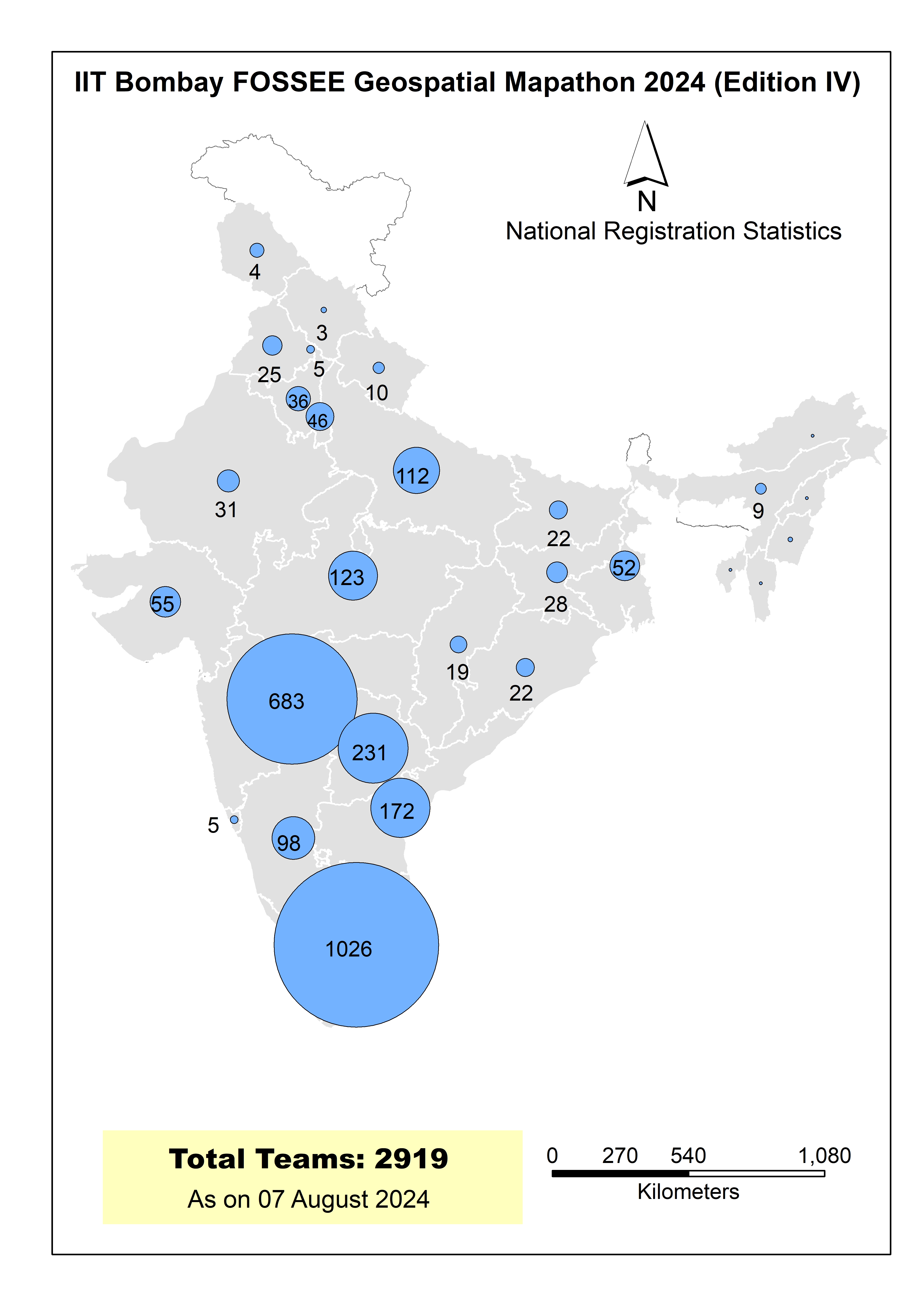
The following is the list of Winners of the IIT Bombay FOSSEE IITTNiF Geospatial Mapathon 2024 (Edition 04)